

![High carrier mobility along the [111] orientation in Cu2O photoelectrodes – Nature](https://media.springernature.com/m685/springer-static/image/art:10.1038/s41586-024-07273-8/MediaObjects/41586_2024_7273_Fig1_HTML.png)


CNN
—
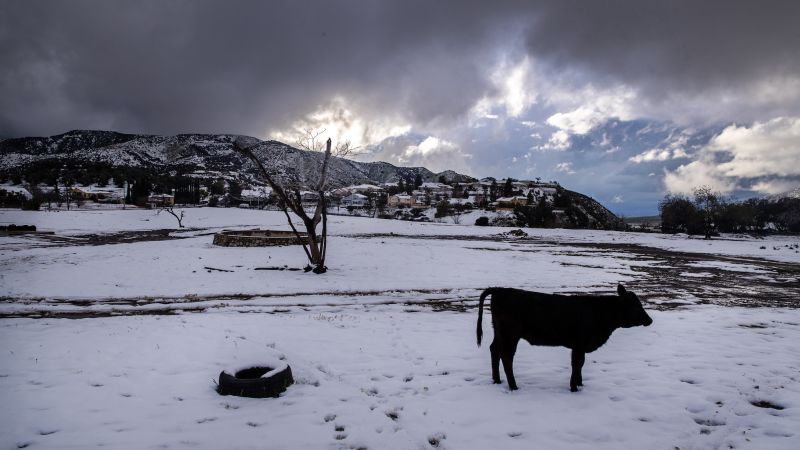
As a ferocious, multiday winter storm begins to subside after delivering heavy snow and ice to a large swath of the country this week and leaving thousands without power in the Midwest, another storm is threatening rain and snow in the West Friday, prompting rare blizzard warnings in Southern California.
In its first-ever blizzard warning, the National Weather Service in San Diego said the San Bernardino County mountains could see 3 to 5 feet of snow through Saturday morning.
Blizzard warnings were also issued for Los Angeles and Ventura counties through Saturday afternoon. Up to 5 feet of snow is possible with some isolated areas seeing between 7 and 8 feet.
“This storm system will be unusually cold, and snow levels will be very low. In fact, areas very close to the Pacific Coast and also into the interior valleys that are not accustomed to seeing snow, may see some accumulating snowfall,” the National Weather Service said early Friday.
“For Friday morning through Saturday afternoon, plan to hunker down and avoid travel. The worst impacts from flooding and blizzard conditions occur Friday afternoon through Saturday morning, when any non-essential or non-emergency travel should be postponed!” the San Diego weather service said.
The storm has put more than 20 million people under flood watches and more than 30 million people under high wind alerts across Southern California – roughly two months after the state endured rounds of deadly flooding. The highest gusts in the warning areas could reach 75 mph.
The system will impact Northern California early in the day Friday. Up to 6 inches of snow is possible across lower elevations and up to 3 feet could fall on the region’s highest peaks before conditions begin to improve by Friday evening as the storm slips to the south.
The Sierra Nevada Mountains could see up to 6 feet of snow Friday into Saturday and in Nevada, a blizzard warning for northwestern Nye County will be in effect Friday morning through early Saturday.
“Heavy snow, winds gusting as high as 60 mph, will cause zero visibility due to blowing and drifting snow,” the weather service warned.
Up to five inches of rain could fall across lower elevations of the greater Los Angeles area while the mountains could see 6 inches. In the San Diego area, up to three inches of rain is possible in lower elevations while the mountains could get 7 inches.
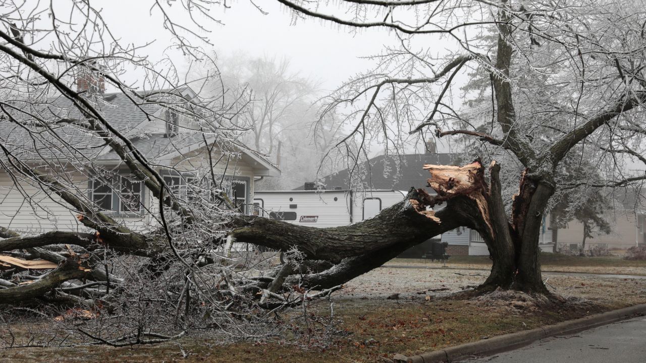
Power outages were already adding up in California early Friday, with nearly 75,000 customers in the dark, largely in the northern region. That accounts for a small portion of the more than 820,000 power outages recorded nationwide as the day began, according to PowerOutage.us. The majority of the outages – nearly 720,000 – were in Michigan, where freezing rain and ice this week damaged utility lines and trees.
This week’s vast, powerful storm wreaked havoc in several states across the West, northern Great Plains the Great Lakes region and New England.
Several counties in Wyoming went into search-and-rescue mode after more than 40 inches of snow fell in the southern parts of the state over the course of several days and motorists were trapped in heavy snow, the state highway patrol said on Twitter.
Minneapolis, Minnesota, saw more than 13 inches in a three-day period this week. More than 160 vehicle crashes were reported statewide, and dozens of cars spun off roads Wednesday, a spokesperson for the Minnesota State Patrol said in a series of tweets.
Since the storm began Monday evening, cumulative snowfall reached dozens of inches in some cities, including 48 inches in Battle Lake, Wyoming, 32 inches in Dupuyer, Montana, and 29 inches in Park City, Utah.
But snow was not the storm’s only culprit. Severe icing was also a danger.
Ann Arbor, Michigan, recorded 0.65 inches, while Fransville, Wisconsin, measured 0.75 inches of ice.
As northern regions of the country were measuring snowfall and ice accumulation, parts of the Southeast were experiencing record-high heat.
More than 50 daily record highs were recorded in the Southeast Thursday.
- St. Simons Island, Georgia, saw a high temperature of 88 degrees, an all-time February record.
- Tupelo, Mississippi, reached a high temperature of 87 degrees, another an all-time February record. The previous record of 84 degrees was set Wednesday.
- Raleigh, North Carolina, saw a high temperature of 85 degrees, which was an all-time February record. The previous record of 84 degrees was set in 1977.
The dueling winter storm and southern heat wave created a stark 100-degree temperature difference between the Northern Rockies and the South earlier this week.
More News
Opinion | Trump’s Act Was Getting Stale. Being a Courtroom Victim Is Just What He Needed.
Why Is This Seder Unlike All Other Seders?
Opinion | This Is What a Miracle Drug Looks Like. And It Only Costs $5 to Make.