


Social media is awash with memes of the next named storm, which shares the same name as Disney’s fictional character from the movie “Frozen.” It may crack a smile for some parents, or even the weather-savvy 5-year-old, but this is one to watch closely.
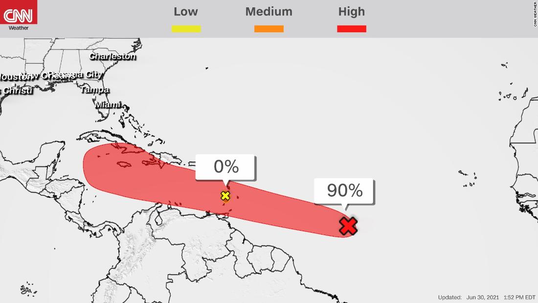
While the nearest area of activity (currently identified as invest 95L) has major hurdles to overcome in the days ahead, the NHC designated the next wave as “Potential Tropical Cyclone Five” Wednesday afternoon.
This tropical disturbance is currently about 1,200 miles east of the Windward Islands.
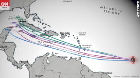
Although any potential interaction with the US mainland wouldn’t occur until the early to middle part of next week, this disturbance is becoming better organized as the hours pass and currently poses a more immediate threat to the Windward and Leeward Islands.
The “Potential Tropical Cyclone” designation was developed several years ago and allows the Hurricane Center to issues watches and warnings on systems that are very close to becoming a tropical depression or storm.
In this case, a tropical storm watch has been issued for St. Vincent and the Grenadines, St. Lucia, Barbados and Martinique.
Recent satellite imagery indicates an area of enhanced thunderstorm activity roughly 2,000 miles southeast of Florida. There are signs of a low level circulation and colder cloud tops, which all point toward a strengthening tropical system.
Potential Tropical Cyclone Five is expected to become better organized and should become Tropical Storm Elsa Wednesday night or Thursday.
The system is currently moving to the west-northwest at a rather brisk pace of 21 mph. And there are indications that the forward speed could increase to near 25 mph. This could potentially bring good news in the short term because “most Atlantic storms in this region moving at 25 knots have trouble strengthening,” according to the NHC.
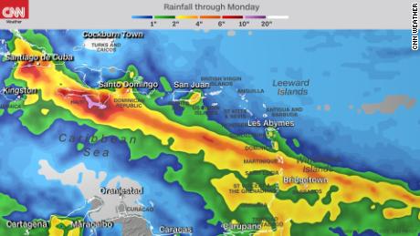
While the storm will bring tropical storm-force winds and heavy rain to the islands Friday, the fast movement could also limit the flood potential.
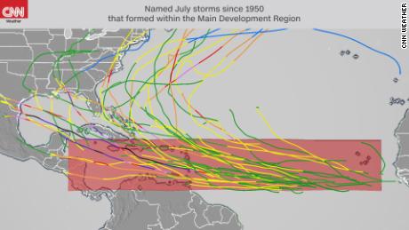
What makes this unique is when and where this activity is developing.
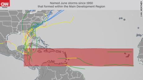
Early-season formation within the Atlantic’s Main Development Region
As the calendar turns from June to July, climatology indicates a significant increase in tropical formation across the Atlantic Ocean’s Main Development Region (MDR). It is however, unusual to see activity within this particular region this early in the hurricane season.
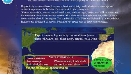
Above-average season off to a weak start
Even though we have amassed four named storms so far in the 2021 Atlantic Hurricane Season, they have been short-lived and relatively weak.
So far this season, the ACE index stands at 3.3, with a mere 5.25 named storm days. If all goes as forecast with invest 97L (soon to be Tropical Storm Elsa), we will begin a steady march toward the forecast above-average season.
CNN’s Monica Garrett contributed to this report.
More News
After the Met Gala, the Parties Lasted All Night
Security Guard Injured in Shooting Outside Drake’s Home in Toronto
From a Dead Dog to a Made-Up Meeting: Takeaways From Kristi Noem’s Book