

Hurricanes — also called tropical cyclones or typhoons outside North America — are enormous heat engines of wind and rain that feed on warm ocean water and moist air. And scientists say the climate crisis is making them more potent.
“We have good confidence that greenhouse warming increases the maximum wind intensity that tropical cyclones can achieve,” Jim Kossin, senior scientist with the Climate Service, an organization that provides climate risk modeling and analytics to governments and businesses, told CNN. “This, in turn, allows for the strongest hurricanes — which are the ones that create the most risk by far — to become even stronger.”
“All of these were devastating to the places where they stalled,” he added. “The combination of slower movement and more rain falling out of them increases coastal and inland flooding risk tremendously.”
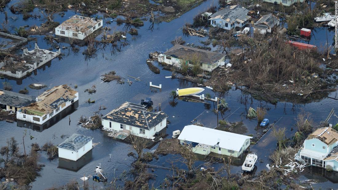
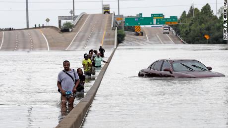
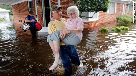
And as storms like Henri makes landfall, torrential rain, damaging winds and storm surge become the most significant, often pernicious, threats. Storm surge, produced by wind blowing ocean water onshore is also expected to get worse over time due to stronger hurricane winds and climate change-fueled sea level rise, according to Kerry Emanuel, a professor of atmospheric science at the Massachusetts Institute of Technology.
“It’s a very dangerous phenomenon,” he said. “And it’s responsible for a lot of the loss of life in the storms.”
“Knowing where they develop and where they move is critical to understanding the threat,” Emanuel said. “So we have to take into account changing tracks, changing intensity, changing frequency, and changing genesis — and we’re confident about some of them and we’re not so confident about other elements.”
Although it’s hard for scientists to tell whether odd storm tracks in the North Atlantic, like Henri’s, are becoming more frequent because of climate change, long-term changes along the coast in the Northeast will ultimately influence the storms that do make landfall there.
“One thing that we might be able to speculate on is that the very unusually warm ocean along the US Northeast coast and Canada has a likely human fingerprint on it,” Kossin added. “These warm waters should allow Henri to maintain greater intensity as it moves northward.”
The 2020 hurricane season tore through the alphabet so quickly that it was forced to use Greek letters as names from September through November. This year’s season is already above average: Atlantic storms beginning with the letter H typically occur toward the end of September, meaning Henri formed more than a month ahead of average.
As the planet rapidly warms, extreme weather events will become more disastrous and possibly harder to predict. Unless climate and emergency management policies are fixed, Emanuel says infrastructure damage and potential loss of life will increase.
“The forecasters’ nightmare is going to bed with a tropical storm in the Gulf of Mexico, headed toward a populated area, and waking up with a Category 4,” Emanuel said. “And as the climate warms, that becomes more and more likely.”
More News
Justice Alito’s Wife Has Managed to Avoid the Spotlight Until Now
The Closing Arguments in the Trump Trial
Democrats Who Are Winning