

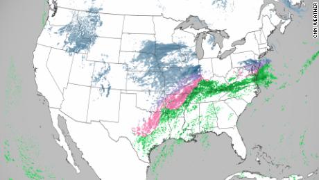
Winter weather alerts stretched over 1,500 miles from Arkansas to Maine on Thursday evening as the ice storm was set to create hazardous travel conditions and possible power outages, as well as a potential flooding threat in the Tennessee and Ohio Valleys.
Ice accumulations greater than 0.25 inches are likely from the Red River Valley of Texas through the Ozarks and southeast Missouri, according to the Weather Prediction Center.
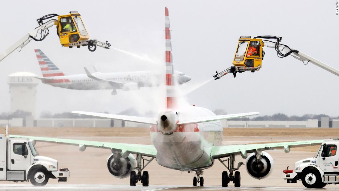
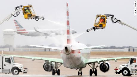
About 1,200 flights on Friday in the US have been canceled, with the worst being in Boston, where 62% of departing flights have already been canceled.
Temperatures have plummeted across the region over the past 24 hours, CNN meteorologist Michael Guy said.
“Austin had temperatures approaching 90° on Tuesday, and within 24 hours were subfreezing — making it the largest 24-hour temperature drop on record, eclipsing the prior record of 51° set in years 1955, 1990 and 1994,” Guy said.
Meanwhile, Arkansas is expected to see the worst of the ice threat.
Up to 0.75 of an inch of ice was expected to form on roads stretching from Little Rock to Jonesboro, a swath that includes Interstates 40 and 30.
There have been several reports across Arkansas noting 0.5 inches of freezing rain, with the highest being 0.75 in Mount Vernon, according to CNN meteorologist Taylor Ward.
“As values exceed 0.5 inches, the hazards increase as significant damage to the electrical grid will begin to take place and widespread tree and power line damage will be observed,” the Little Rock weather service said. “Travel will become near impossible with many roads blocked by fallen tree(s) and power line debris along with power outages in the range of hours to several days.”
There are about 32,000 customer without power in Arkansas, Ward said.
What the Northeast can expect
The storm is expected to shift east overnight into Friday, setting up a wintry mess in the Northeast with the potential for more ice concerns, especially in the Appalachians and western Pennsylvania.
Forecasters predict the storm will dump substantial amounts of snow as well as cause ice accumulations as it churns into the southern New England region on Friday.
“Heavy snow is expected across Upstate New York and New England on Friday when snow rates will likely eclipse 1″/hr at times. Dangerous travel is likely,” the weather service tweeted.
Ahead of the winter storm, Massachusetts Gov. Charlie Baker urged people to stay off the roads and be prepared for the possibility of power outages.
Temperatures have already plunged around 40 degrees across the Northeast after widespread record warmth was felt Wednesday. Boston set a daily record high of 69 degrees on Wednesday afternoon, but that warmth dropped to 23 degrees Thursday morning.
Six inches of snow or more is expected across much of the Northeast and southern New England, with areas of Massachusetts likely to see almost a foot of snow. Boston could see about 9 inches by week’s end.
About 2.5 inches of snow are in store for New York City, according to forecasts. The snow is expected to begin around midnight Thursday, turning to sleet, then freezing rain and eventually rain by late Friday morning.
CNN’s Caitlin Kaiser, Judson Jones, Brandon Miller, Sharif Paget and Greg Wallace contributed to this report.
More News
Morgan Spurlock, Documentarian Known for ‘Super Size Me,’ Dies at 53
Raw Milk Containing Bird-Flu Virus Can Sicken Mice, Study Finds
Ozempic Cuts Risk of Chronic Kidney Disease Complications, Study Finds